 |
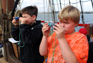
In truth, the tracking of celestial objects is as much shipcraft as river science. In 1609 (and indeed, for thousands of years before that and to this very day), celestial navigation was a crucial aspect of nautical life. On this voyage, the research team of Ben and Brandon will study celestial tracking for their presentation project.
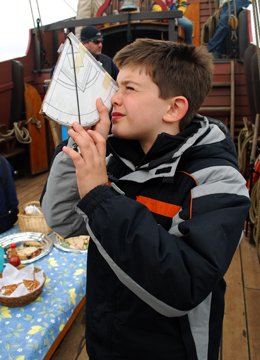
We use a traditional instrument called a quadrant (see Brandon to the right) to measure the angle of celestial objects above the horizon; these include the sun and various stars.
|
Captain Hudson himself would have used this instrument to determine his latitude (his position on the north-south axis of the globe). The quadrant is so named because it forms one quarter of a circle (a 90-degree angle). 0 degrees represents the equator, while 90 degrees represents the north pole. Gravity pulls the dangling plumb bob straight down toward the center of the Earth. A navigator in the northern hemisphere can look up along the quadrant's flat edge to observe Polaris, the north star; the resulting angle indicated by the plumb bob would then indicate the user's northern latitude. (See the Daily Logs for our latitudes at each anchorage throughout the voyage).
|
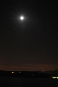
The waning half moon
as seen from Newburgh Bay,
Oct. 11th, 0335 hours.
 |
By tracking the Sun, we can determine the time of local true noon (when the Sun reaches its zenith, the point at which it is highest in the sky), which can differentiate from the local standardized time by nearly up to an hour, depending on one's location in a time zone. In the northern hemisphere, the compass bearing of the sun (its azimuth) at local true noon in turn determines truesouth. Thus, a celestial navigator could use a quadrant and the sun to calibrate a compass.
Of course, overcast skies can prove a serious annoyance, since they hide a navigator's celestial reference points. This holds true whether you're just trying to observe the Sun for a project or a sailor lost at sea in the Northern Atlantic. On this voyage, Ben and Brandon were nearly forced to cancel their celestial tracking presentation project (which would have meant switching their topic to the study of mechanical advantage), but the cloud cover finally broke just before they were due to start collecting data.
|
|
|