 |
|
|
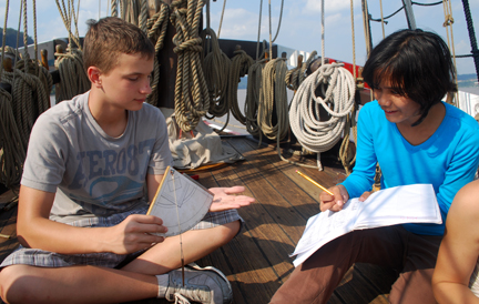
In truth, the tracking of celestial objects is as much shipcraft as river science. In 1609 (and indeed, for thousands of years before that and to this very day), celestial navigation was a crucial aspect of nautical life. On this voyage, the research team of Johanan, Josh, Mae, and Paula studied celestial tracking for their presentation project, measuring the height and compass bearing of the sun as it arced through the sky, and then using that data to determine the ship's latitude and longitude.
We use a traditional instrument called a quadrant (pictured, right) to measure the angle of celestial objects above the horizon. Captain Hudson himself would have used this instrument to determine his latitude (his position on the north-south axis of the globe). The quadrant is so named because it forms one quarter of a circle (a 90˚ angle). 0˚ represents the equator, while 90˚ represents the north pole. Gravity pulls the dangling plumb bob straight down toward the center of the Earth. A navigator in the northern hemisphere can look up along the quadrant's flat edge to observe Polaris, the north star; the resulting angle indicated by the plumb bob would then indicate the user's northern latitude. (These same measurements are used to record the ship's track throughout the voyage today.)
|
By tracking the sun, we can determine the time of local noon (when the sun reaches its zenith, the point at which it is highest in the sky), which can differentiate from the local standardized time by more than an hour, depending on daylight savings time and one's location in the time zone. In the northern hemisphere, the compass bearing of the sun (its azimuth) at local noon in turn determines true south (which is 180˚ opposite from true north, as opposed to magnetic north). Thus, a celestial navigator could use a quadrant and the sun to calibrate their compass.
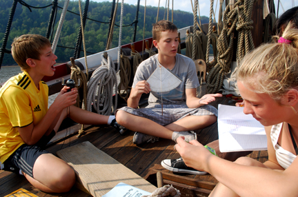
Of course, overcast skies can prove a serious annoyance, since they hide a navigator's celestial reference points. This holds true whether you're just trying to observe the sun for a project or a sailor lost at sea in the Northern Atlantic. On this voyage, consistently thick cloud cover on Day Three threatened to force the Celestial Tracking research team to switch to a different project topic. Fortunately, the skies cleared during our layover off the Palisades, giving the team the opportunity they needed to collect their data.
|
|
|
