 |
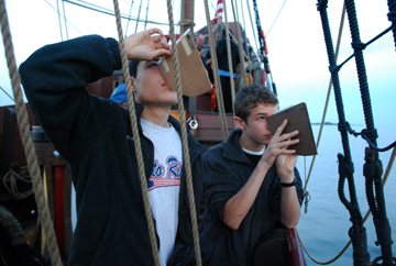
In truth, the tracking of celestial objects is as much shipcraft as river science. In 1609 (and indeed, for thousands of years before that and to this very day), celestial navigation was a crucial aspect of nautical life. On this voyage, the research team of Amanda, Bibi, Karl, and Monet studied celestial tracking for their presentation project.
|
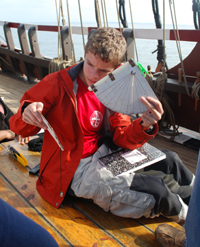
We use a traditional instrument called a quadrant to measure the angle of celestial objects above the horizon. On this voyage, students measured the height of the sun, the moon, and Jupiter.
Captain Hudson himself would have used this instrument to determine his latitude (his position on the north-south axis of the globe). The quadrant is so named because it forms one quarter of a circle (a 90˚ angle). 0˚ represents the equator, while 90˚ represents the north pole. Gravity pulls the dangling plumb bob straight down toward the center of the Earth. A navigator in the northern hemisphere can look up along the quadrant's flat edge to observe Polaris, the north star; the resulting angle indicated by the plumb bob would then indicate the user's northern latitude. (See the Daily Logs for our latitudes at each stop throughout the voyage).
|
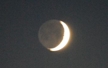
The waxing crescent moon as seen from
Niantic Bay, Oct. 10th, 1912 hours.
 |
By tracking the sun, we can determine the time of local noon (when the sun reaches its zenith, the point at which it is highest in the sky), which can differentiate from the local standardized time by more than an hour, depending on daylight savings time and one's location in the time zone. In the northern hemisphere, the compass bearing of the sun (its azimuth) at local noon in turn determines true south (which is 180˚ opposite from true north, as opposed to magnetic north). Thus, a celestial navigator could use a quadrant and the sun to calibrate a compass.
|
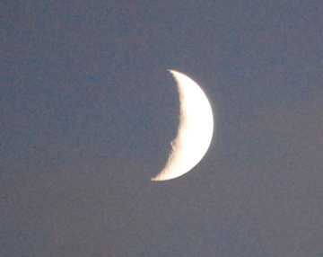
The waxing crescent moon as seen from
Old Lyme, Oct. 12th, 1839 hours.
 |
Of course, overcast skies can prove a serious annoyance, since they hide a navigator's celestial reference points. This holds true whether you're just trying to observe the sun for a project or a sailor lost at sea in the Northern Atlantic.
These techniques have terrestial uses as well. The same methods we use to measure the altitude of celestial objects can also be used to measure the height of objects such as bridges, and power lines, both of which came into play as we traveled up the Connecticut River.
|
|
|