 |
|
|
|
Presentation Project Topics |
|
|
|
|
|
|
Days Three, Four, and Five of our Voyage of Discovery were dedicated to collecting the data the students would need to test their hypotheses. Most students collected their data while the Half Moon was at layover on the Kill Van Kull on Day Five, with the exception of Isis and Sofia, who performed their salinity research while the ship was underway from Newburgh to Raritan Bay on Days Three and Four.
During the data collection phase, each student research team established a work schedule for gathering data, collected and analyzed samples, and recorded their findings.
You can scroll down or use the links to jump directly to a section.
|
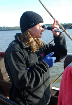
Research Team 1: Celestial Tracking
|
|  
Students: Ben & Brandon
Senior Crew Advisor: Erik Berg
Hypothesis: We believe that the angle of the Sun will in the morning will mirror that in the afternoon, but the bearings will be completely opposite.
Materials: Quadrant, directional compass, clock.
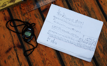
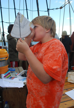
Procedure: Ben and Brandon performed their celestial tracking project during the ship's data collection layover at the Kill Van Kull. They aimed the quadrant at the Sun to determine its elevation in degrees, using the quadrant's shadow to properly align it, rather than looking directly into the Sun. At the same time, they used the directional compass to mark the Sun's bearing, or azimuth. Starting in the late morning, they initially took readings once every fifteen minutes, but as we approached 1200 hours, they increased the interval between each reading to as little as 2 to 3 minutes until the Sun reached its highest point, or zenith.
Back to Top
|
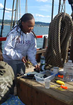
Research Team 2: Statistical Analysis
Students: Dante & Erin
Senior Crew Advisor: Kipp Van Aken
Materials: Quadrant, directional compass, Half Moon crew members.
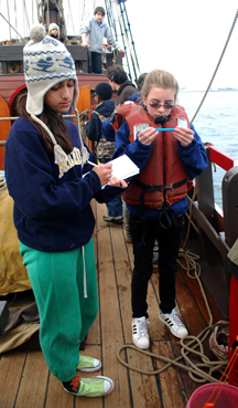
Procedure: At three different times during our Voyage of Discovery -- the last two taking place during our layover at the Kill Van Kull -- Dante and Erin selected a distant, fixed point (including a river marker, a flagpole, and the top of a smokestack) and used a quadrant and directional compass to find its altitude and bearing, utilizing the same techniques used for celestial tracking. They then gathered the crew and had each crew member in turn take a reading. With all this data in hand, they then performed a statistical analysis of the crew's findings, seeking the mean, median, and mode averages.
|
Research Team 3: Comparative Temperatures
Students: Isabel & Taylor
Senior Crew Advisor: Nico Gans
Materials: Digital thermometer, wet thermometer, canvas bucket tied to the rail.
Procedure: During the ship's data collection layover at the Kill Van Kull, Izzy and Taylor used thermometers and a canvas bucket to measure the temperature of the air and surface water, taking simultaneous readings of each on the hour and half hour. With the help of Anchor Watch, they continued to collect data for a full 24 hours.
Back to Top
|
Research Team 4: Salinity
Students: Isis & Sofia
Senior Crew Advisor: Marion Bruijn
Materials: Refractometer, eyedropper, distilled water, canvas bucket tied to the rail.
Procedure: During the Half Moon's journey downriver, Isis and Sofia collected surface water samples once every fifteen minutes whenever the ship was underway, taking their first reading at Newburgh Bay and their final reading as we entered Raritan Bay. As soon as each water sample was collected, they used the refractometer to measure the salinity gradient at that location. In between readings, they used the eyedropper and distilled water to clean the refractometer and thus avoid contaminating their data.
Back to Top
|
Research Team 5: Current Patterns 
Students: Abigail & Grace
Senior Crew Advisor: Kees Collens
Materials: Wooden biscuits, apple peels, banana peels, stopwatch.
Procedure: During our data layover at the Kill Van Kull, Abigail and Grace measured the amount of time it took for a floating marker to drift a fixed distance (close to the length of the weather deck) to determine the speed and direction of the current. They took readings every half an hour, and with the help of Anchor Watch, recorded the current patterns over the course of a full 24 hours. They quickly discovered that high winds were interfering with the lightweight wooden biscuits, so they switched to heavier biodegradable markers -- first apple peels, and then banana peels.
Back to Top
|
Research Team 6: Height of Tide
Students: Jason & Matt
Senior Crew Advisor: Rachel Laufer
Materials: Flashlight, depth measurement board.
Procedure: Upon our arrival at Atlantic Salt on the Kill Van Kull, the crew erected a borrowed depth measurement board on the dock. Jason and Matt then used this board to gauge changes in the height of tide throughout a tidal cycle. They took readings once every half an hour, and with the help of Anchor Watch, collected data over a full 24-hour period.
|
|
|
|
|
|